Project 1: RS Image processing competencies with the identification of Red Roof houses.
Project 1.1: Unsupervised Classification:
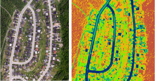
The following image processed with Unsupervised Classification method. This is indeed a quick process to have an idea on the overall objects. The image below shows original one (left) and classified one (right). In this classification the classified and original images show that there is boundary cross, for example dark blue and light blue color shared both road and some roof top features.
Project 1.2: Supervised Classification:
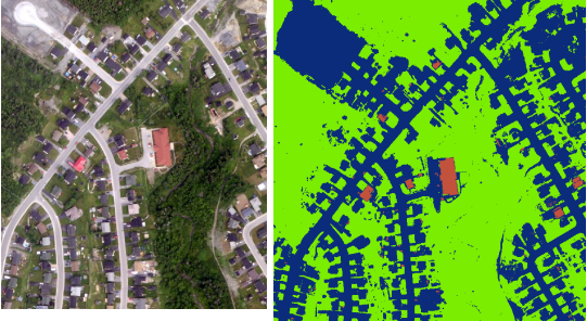
In this classification method (Supervised Classification) the original image classified with satisfied accuracy. There are a few speckles found on this classes. It is obvious that black rooftops, road, paved spaces remain in the same classes. Therefore, this is worthy image processing.
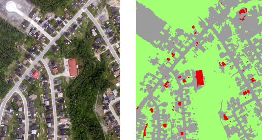
In this object based image analysis the output brings quite acceptable result. All the red rooftop houses classified properly, similarly other impervious and pervious features are properly classified using Support Vector Machine (SVM) method. Now, we have the red-roof houses identified for insurance claim, tax impose, repair maintenance and other purposes.
Object-Based Image Analysis (OBIA) - Identify Fire Burnt Forest (think about an object, not Pixel)
LANDSAT 8: June 20, 2020
SEGMENTATION: Do breaks in the image up into objects representing land-based features.
CLASSIFICATION: It’s now easy to classify those objects using their shape, size, spatial, and spectral properties.